
Seismic You Can Bank OnWhen your success depends on quality seismic data, turn to the professionals and vast multi-client library at Geophysical Pursuit Inc. (GPI). For more than 30 years, both large and small energy companies have counted on GPI to supply the seismic required to make the right decisions.
GPI owns what it licenses. Through joint ventures or on our own, we’ve acquired approximately 21,000 miles of 2-D data and nearly 18,000 mi2 of 3-D data. Quality data in mature and pioneer regions could make GPI your primary seismic provider. |

Drill with confidence. Since 1984, GPI-owned seismic data has helped energy companies make the best drilling choices.
|
U.S. Onshore Announcement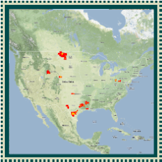
GPI is pleased to announce new 3D seismic surveys in one of the most active onshore oil plays in the U.S., the Permian Basin. The Flying Dutchman surveys are located in the heart of the Midland Basin in Midland and Upton Counties, Texas. The projects use modern, high effort, wide azimuth three-dimensional imaging to assist operators in optimizing their drilling, completion and production strategies in order to maximize the stacked pay potential of the Midland Basin. The first 290 square mile survey, Flying Dutchman, has been completed and is available for licensing. The 111 square mile FD East extension is underway and processed data will be available in late 2017.
Download the map or brochure for additional information. U.S. Onshore Announcement
GPI is pleased to announce new 3D seismic surveys in one of the most active onshore oil plays in the U.S., the Permian Basin. The Flying Dutchman surveys are located in the heart of the Midland Basin in Midland and Upton Counties, Texas. The projects use modern, high effort, wide azimuth three-dimensional imaging to assist operators in optimizing their drilling, completion and production strategies in order to maximize the stacked pay potential of the Midland Basin. The first 290 square mile survey, Flying Dutchman, has been completed and is available for licensing. The 111 square mile FD East extension is underway and processed data will be available in late 2017.
Download the map or brochure for additional information. |
Flex Trend WAZ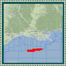
Geophysical Pursuit and WesternGeco completed the acquisition of a new Wide Azimuth program along the Gulf of Mexico shelf break in January 2014.
The Flex Trend WAZ project covers 296 blocks in an area where no legacy long-offset or wide azimuth data exists. The initial FastTrack has been released and is available. The final RTM TTI depth products will be available for delivery by year end 2014. Please contact us for licensing inquiries. Download map or brochure for additional information. |